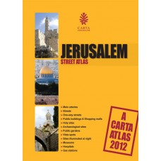
Jerusalem Street Atlas 2012 - Imperfect
Jerusalem Street Atlas 2012 - Imperfect
SKU: PB470D
Couldn't load pickup availability
Modern, user-friendly and up-to-date, Carta's Jerusalem Street Atlas is part of Carta's long established atlas series.
Modern, user-friendly and up-to-date, Carta's Jerusalem Street Atlas is part of Carta's long-established atlas series.
Whether by car or on foot Carta's Jerusalem Street Atlas - easy to read and packed with useful information - is a must for residents and visitors alike.
Let Carta's Jerusalem Street Atlas be your guide to the sites and unparalleled beauty of the eternal city.
ENLARGED MAP OF THE OLD CITY OF JERUSALEM
About Carta:
Established in 1958, Carta Jerusalem is Israel's foremost cartographic publisher and among the leaders in academic publications. With special emphasis on biblical Israel and the ancient Near East, CARTA Map Bank is one of the world's largest map collections in the fields of religion, geography, history, and Israel - ancient to modern - with its unique fauna and flora. Sciences, environmental studies, medicine, and other subjects are covered on an ongoing basis, also in popular editions.
Keeping up with fast-developing Modern Israel has been another major focus of CARTA's activities, covering every highway, road and byway, city, town, and village in great detail, many shapes and different sizes. Touring and special guides to archaeological sites, national parks, and nature reserves are continuously being expanded.
Featuring:
Maps
Full Color
Fully Indexed
Language: English
Spiral Bound
96 pages
5½ x 10½ in. (14 x 26.5 cm)
Scale (map of Israel) 1:190,000
- Sun Damage at Spiral Binding & Damaged Corners or back cover is upside-down.
- Sale Final
Additional Information
Additional Information
Share


