Israel Super Touring Map from Carta
Israel Super Touring Map from Carta
SKU: PB471
Couldn't load pickup availability
A modern touring map with maps of Jerusalem & Tel Aviv
Additional Information
Additional Information
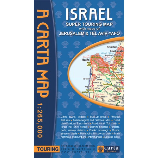
Israel Super Touring Map - Carta Maps
Plan your next trip to Jerusalem or Tel Aviv with great ease and efficiency. This handy map will provide you with all the information you need to plan any sort of trip, long or short, anywhere in the country.
By: Carta Jerusalem
With maps of Jerusalem & Tel Aviv-Yafo
Cities, towns, villages • Built–up areas • Physical features • Archaeological and historical sites • Road classifications & numbers • Road No. 6 (Toll road) • Israel Trail (Shvil Yisrael) • Bathing beaches • Airports, ports, railway stations • Border crossings • Rivers, streams, wadis • Reservoirs, fish ponds, wells • Main highways and numbers • Interchanges • Detailed index
About Carta:
Established in 1958, Carta Jerusalem is Israel's foremost cartographic publisher and among the leaders in academic publications. With special emphasis on biblical Israel and the ancient Near East, CARTA Map Bank is one of the world's largest map collections in the fields of religion, geography, history, and Israel - ancient to modern - with its unique fauna and flora. Sciences, environmental studies, medicine, and other subjects are covered on an ongoing basis, also in popular editions.
Keeping up with fast-developing Modern Israel has been another major focus of CARTA's activities, covering every highway, road and byway, city, town, and village in great detail, many shapes and different sizes. Touring and special guides to archaeological sites, national parks, and nature reserves are continuously being expanded.
Scale: 1:265,000
Soft Cover
24x35½ in. (60x90 cm), folds to 5¼x9¼ in. (13.5x23.5 cm)
Share
